Industrial Services
Pipeline ROW Vegetation Control
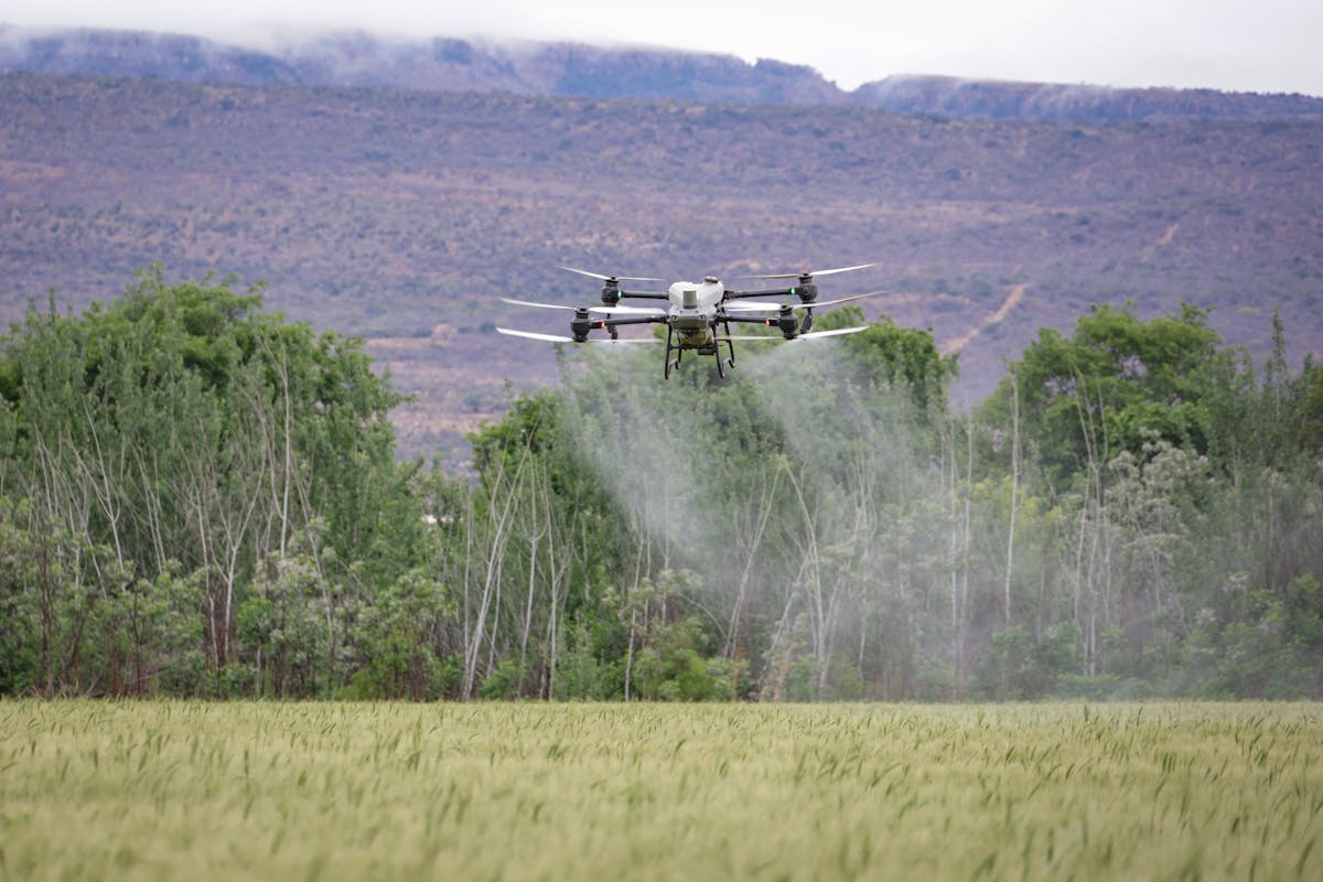
Low-drift drone spraying for pipeline corridors across central Alberta
AgHawk Drones provides low-drift drone herbicide spraying along pipeline rights-of-way throughout central Alberta. Pricing runs $20–$35 per acre depending on corridor width, vegetation density, and terrain. This service is fully permitted today under existing industrial herbicide labels and available May through October.
What You Get
- ✓ Low-drift spray system designed for environmentally sensitive corridors
- ✓ GPS-mapped treatment records for regulatory compliance reporting
- ✓ No soil compaction or surface disruption along the right-of-way
- ✓ Efficient coverage of long, narrow corridors that ground crews struggle with
- ✓ Supports Integrated Vegetation Management (IVM) plans
- ✓ Access to wet, rough, or treed terrain without heavy equipment
Best For
- ✓ Pipeline operators (transmission and gathering systems) managing vegetation on ROWs
- ✓ Corridors through wet, rough, or heavily treed terrain
- ✓ Maintaining safe access to valves, markers, and monitoring points
- ✓ Reducing reliance on heavy ground equipment in sensitive areas
- ✓ Operators needing documented treatment records for regulatory reporting
How It Works
Corridor Review
You provide ROW coordinates and vegetation management objectives. We plan flight paths and select the right herbicide program.
Flight Planning
We map the corridor with GPS waypoints, identify buffer zones near waterways, and confirm application parameters.
Drone Application
GPS-guided drone follows the corridor applying herbicide with low-drift nozzles. No ground equipment enters the ROW.
Treatment Records
You receive GPS-mapped treatment records, application data, and documentation for your IVM reporting.
Drone vs. Ground Crew with Backpack Sprayers
| Factor | Drone Spraying | Backpack Sprayer Crew |
|---|---|---|
| Cost per acre | $20–$35 | $40–$80+ (labour-intensive) |
| Coverage speed | 40–60+ acres per hour | 2–5 acres per hour per worker |
| Ground disturbance | None | Foot traffic, ATV trails |
| Terrain access | Flies over wet, steep, or rough ground | Difficult in wet or steep conditions |
| Precision | GPS-guided, consistent coverage | Variable, depends on operator |
| Compliance documentation | Automatic GPS logs and maps | Manual record-keeping |
Pricing
$20–$35 per acre
Based on corridor width, vegetation density, and terrain difficulty
- ✓ GPS-mapped treatment records included
- ✓ IVM-compatible documentation for regulatory reporting
- ✓ Contract pricing available for ongoing maintenance programs
Season: May–October. Serving pipeline operators throughout central Alberta including Red Deer, Lacombe, Ponoka, Wetaskiwin, Innisfail, and surrounding areas.
Frequently Asked Questions
We target brush, woody regrowth, noxious weeds, and broadleaf vegetation that encroach on pipeline rights-of-way. The specific herbicide and application rate are selected based on the target species and corridor conditions to support your Integrated Vegetation Management plan.
Drone spraying is one tool in a broader IVM approach. We provide targeted herbicide application as the chemical control component, paired with GPS-mapped treatment records that document exactly what was treated, when, and where. This data integrates directly into your IVM reporting and planning.
Yes. Drones are well suited to pipeline rights-of-way because they follow GPS-programmed flight paths along the corridor. They cover long, narrow strips more efficiently than ground crews with backpack sprayers, and there is no need to drag equipment through difficult terrain.
We serve pipeline operators of all sizes across central Alberta, from large transmission operators to smaller gathering system companies. Our service includes the compliance documentation and GPS records that larger operators require for their vegetation management programs.
Our low-drift spray system is designed for environmentally sensitive corridors. We maintain required buffer zones around waterways and wetlands, and GPS flight records document that treated areas stay within approved boundaries. Product selection also accounts for proximity to sensitive features.
Need Vegetation Control Along Your Pipeline Corridor?
Get a quote for low-drift drone spraying along your pipeline rights-of-way in central Alberta.
Request a Free Quote